Environment
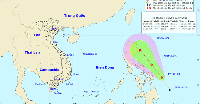
Ability to appear Storm No. 2 into the South China Sea
According to the Central Intelligence Center, on July 28, a tropical depression existed in the Eastern Philippines.
Browse ScienceInfo articles and explainers related to East Sea.
198 published items.
According to the Central Intelligence Center, on July 28, a tropical depression existed in the Eastern Philippines.
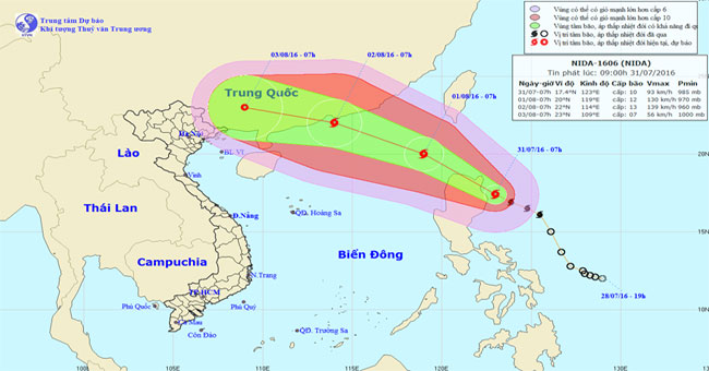
Tropical depression strengthened into a storm in the East Sea, with its international name Nida. The strongest wind power is near the center of a strong storm level 12,…
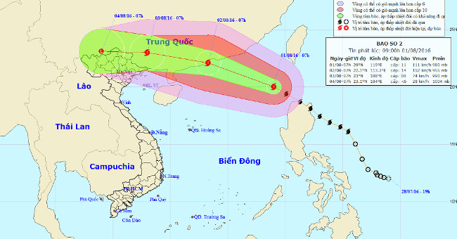
At 08:00 on August 1, the location of the center of the storm is about 20.1 degrees North latitude; 118.9 degrees Kinh Dong, about 560 km southeast of Hong Kong.
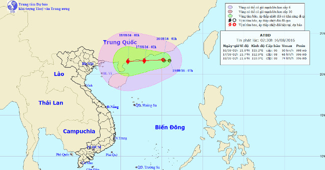
Central Center for Hydrometeorological Forecasting said that at 2 o'clock on August 16, the position of the tropical depression center was about 21.8 degrees Vi Bac; 115…
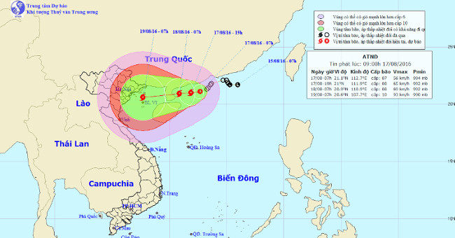
Tropical depressions in the Gulf of Tonkin have weakened and faded away. Meanwhile, tropical depressions formed in the North China Sea are still moving and are likely to…
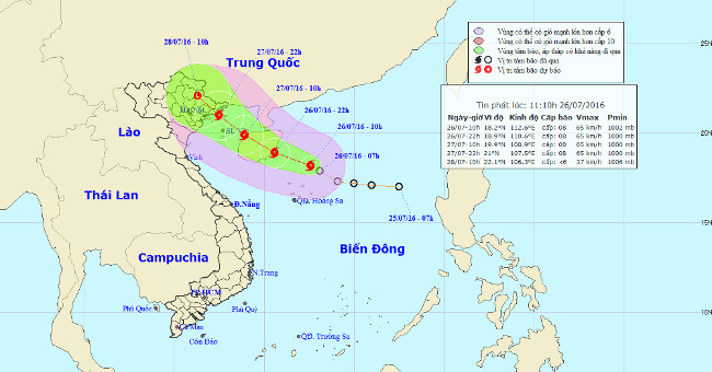
At noon today (July 26), after going into the northeastern area of the Paracel Islands, the tropical depression intensified into a storm. Storm No. 1.
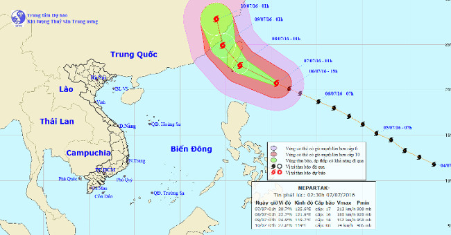
Super typhoon named Nepartak has just appeared in the waters off the northeastern island of Luzon (Philippines) but it is unlikely to affect the mainland of Vietnam.
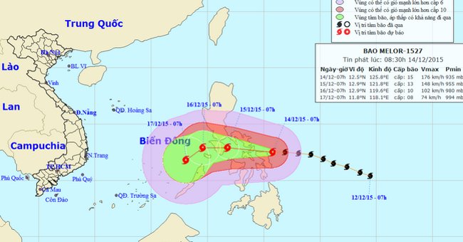
At 08:00 on December 14, the location of the center of the storm Melor was about 12.6 degrees north latitude; 125.6 degrees east longitude, on the central waters of the…
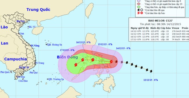
At 14:00 on December 14, the location of the center of the storm Melor was about 12.6 degrees North latitude; 124.6 degrees east longitude, on the eastern region, centra…
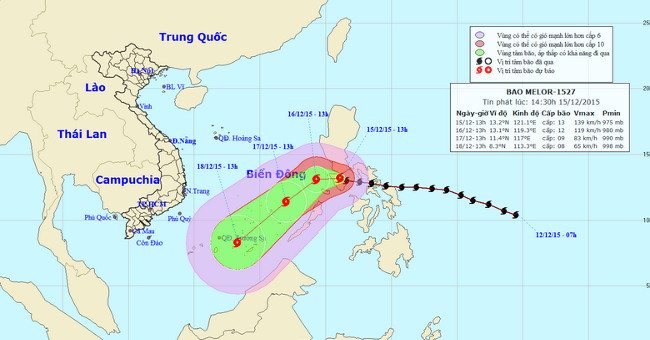
At 14 o'clock on December 15, the location of the center of the storm Melor was about 13.2 degrees Vi Bac; 121.1 degrees Kinh Dong, in the Central Philippines region.
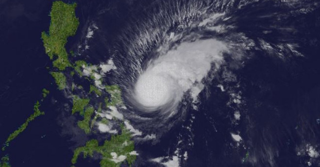
At least 3 people died and tens of thousands of people were evacuated when super typhoon Melor began to land Philippines last night.
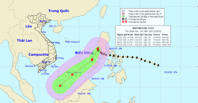
At 14 o'clock on December 16, the location of the center of the storm was about 14.5 degrees north latitude; 119.6 Kinh Dong, about 680km from Song Tu Tay Island (belong…

While Filipinos are coping with the consequences of super typhoon Melor, a tropical depression may intensify into a storm that will continue to land on the island on Dec…
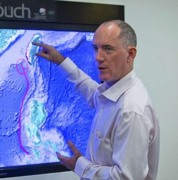
Scientists on Oct. 22 warn of potential tsunami areas on the southwest coast of Taiwan after shedding light on a mysterious tsunami that occurred in the area in the 18th…
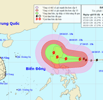
Currently, a very strong storm is operating in the waters off the eastern Philippines and has an international name as Koppu.